Town Flood Insurance Rates Should See ‘Drastic’ Drop
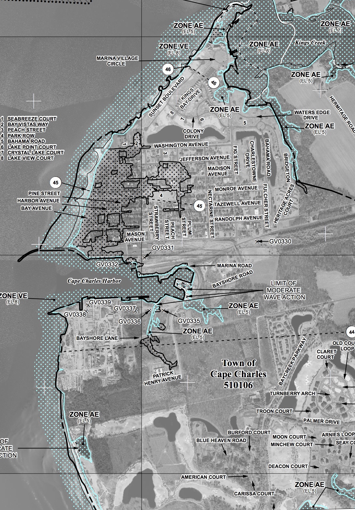
Click on map to view larger image. (An additional click may be required on larger image.) As proposed, only a few tiny areas in the entire Town of Cape Charles are classified “AE,” which requires flood insurance to obtain a mortgage. On the current 2008 flood map (not shown), a majority of the Historic District is classified “AE.”
By DORIE SOUTHERN
Cape Charles Wave
July 11, 2013
FEMA (Federal Emergency Management Agency) is proposing “a drastic change regarding flood zones in Cape Charles.”
Town Planner Rob Testerman told the Cape Charles Planning Commission July 9 that a majority of the Historic District, currently rated high-risk by FEMA, is proposed to be reclassified at a much lower risk of flooding.
That is wonderful news to any property owner paying flood insurance premiums.
Under FEMA rules, federally regulated lenders require property owners to buy flood insurance in areas labeled “A or “V” on the FEMA flood zone map.
In high-risk areas, there is at least a 1 in 4 chance of flooding during a 30-year period.
In the current 2008 FEMA map, “a majority of the historic portion of Cape Charles is located in the AE Zone,” Testerman said.
But the preliminary map for 2013 “shows the AE zone ending at the beach,“ he noted.
The most flood-prone area is of course the beach itself, which retains a “VE” classification. [Read more…]